- New OAS Ambassador for Belize
- Youth killed another injured
- President of Haiti assassinated; Belize sends condolences
- Tropical Storm Elsa forming
- Toledo top-cop gives pep talk to baseball/softball players
- New CEO for Ministry of Sustainable Development
- Cold front cools things down
- Mike Espat takes Oath of Office
- 2020 Hurricane Season comes to a close
- COVID-19 death toll rises
Pacific Tropical Storm Selma to bring heavy rains over southern Belize
San Ignacio, CAYO. Friday, October 27, 2017. We normally prepare for tropical storms and hurricanes from the East that race across the Caribbean Sea.
But tonight a storm that is approaching from the south, more precisely from the Pacific Ocean, is likely to bring torrential rains over the Toledo district this weekend.
Tropical Storm Selma is approaching the Guatemala/El Salvador border and in advance of the storm’s arrival on the Central American mainland, moisture ahead of the system will give rise to unstable weather conditions over Belize, particularly the central and southern areas of the country.
Officials from NEMO and the Belize Weather Bureau say they do not expect Tropical Storm Selma to cross Belize.
But its proximity to the country will bring increased shower activity on Saturday and on Sunday.An advisory issued by the National Emergency Management Organization, NEMO today calls on residents, particularly of the Toledo district “to be prepared for possible heavy rainfall and flash floods.”
According to the Miami-based National Hurricane Center, “Selma is expected to produce total rain accumulations of 3 to 6 inches over El Salvador, southern Guatemala, southern Honduras and far western Nicaragua over the next couple of days.”
The NHC says that “isolated maximum amounts of 10 inches are possible in El Salvador and southern Guatemala,” rainfall amounts that “could cause life-threatening flash floods and mudslides.”
Meanwhile, the broad area of low pressure that has been lingering offshore Nicaragua is showing signs of development.It continues to move in a northerly direction and does not pose any threat to Belize at this time as most of the heavy winds and rains are on the eastern side of the system and well out to sea.
It is expected to gradually turn to the north-east later this weekend.
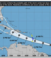
Late this evening, the National Hurricane Center issued its first advisory on the system, designating it as a potential Tropical Cyclone 18, placing it near latitude 17.8 North, longitude 84.5 West.
The NHC advisory says tht the Tropical Disturbance has maximum sustained winds near 40 miles per hour with higher gusts and some strengthening is forecast during the next 24 to 36 hours.It is currently moving toward the north-northwest at near 6 miles per hour; but a “a faster motion toward the northeast on Saturday and Sunday. On the forecast track, the system will move across western Cuba late Saturday and move through the northwestern Bahamas Saturday night and early Sunday.”

![Tropical Storm Selma [Courtesy NOAA]](http://www.westvision.bz/wp-content/uploads/2017/10/173716-300x246.png)
![T..S. Selma [NHC graphic]](http://www.westvision.bz/wp-content/uploads/2017/10/173716_earliest_reasonable_toa_no_wsp_34-300x246.png)
![Tropical Disturbance [NOAA map]](http://www.westvision.bz/wp-content/uploads/2017/10/TD-18-300x246.png)
![Potential Tropical Cyclone 18 [NOAA map]](http://www.westvision.bz/wp-content/uploads/2017/10/td-18-1-300x246.png)


